Live conditions, always current.
USGS streams instant-value readings throughout the day. RiverFlow fetches the latest measurement each time you open the app — no manual refresh needed.
Live USGS water station data
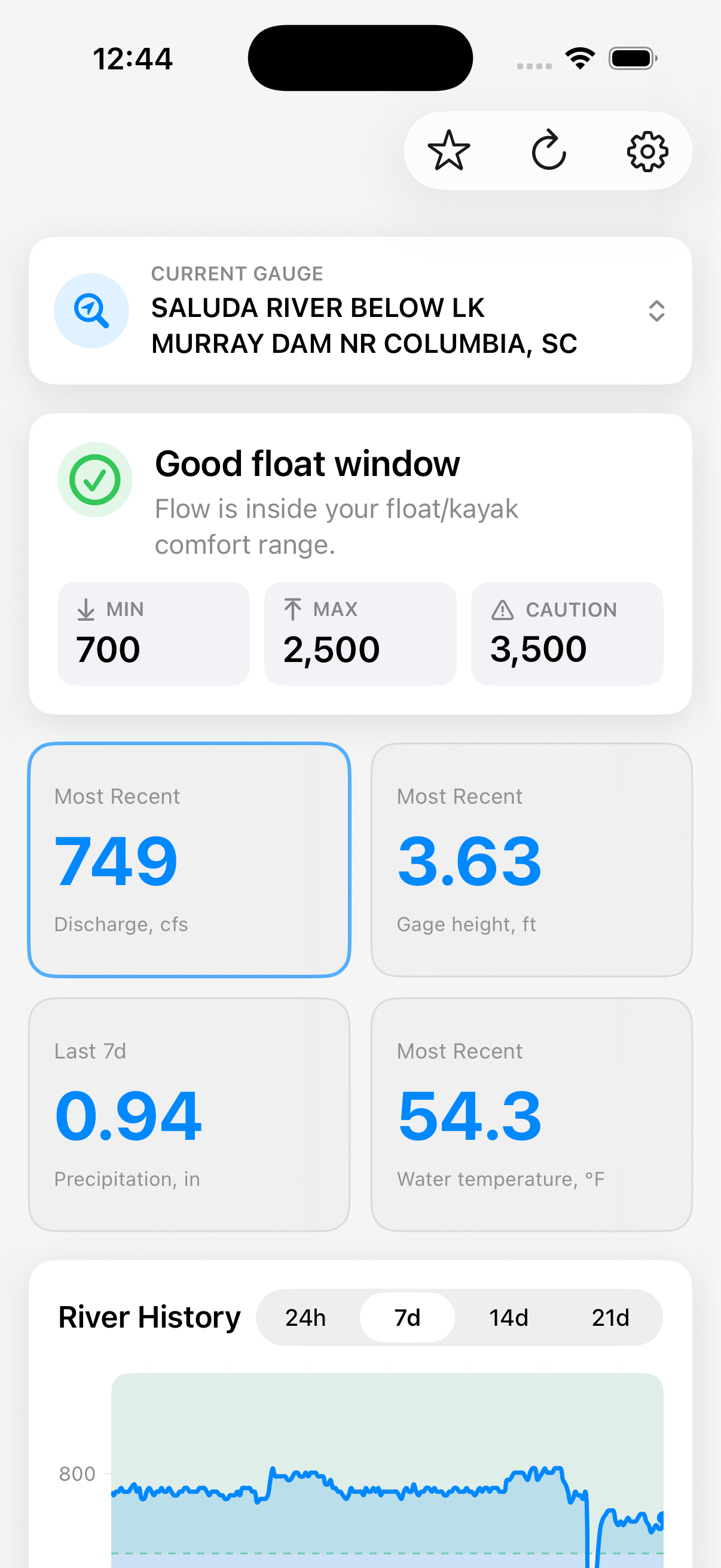
RiverFlow surfaces real-time USGS measurements — discharge, gage height, water temperature, and precipitation — in a clean iPhone app built for people who live on the water.
USGS streams instant-value readings throughout the day. RiverFlow fetches the latest measurement each time you open the app — no manual refresh needed.
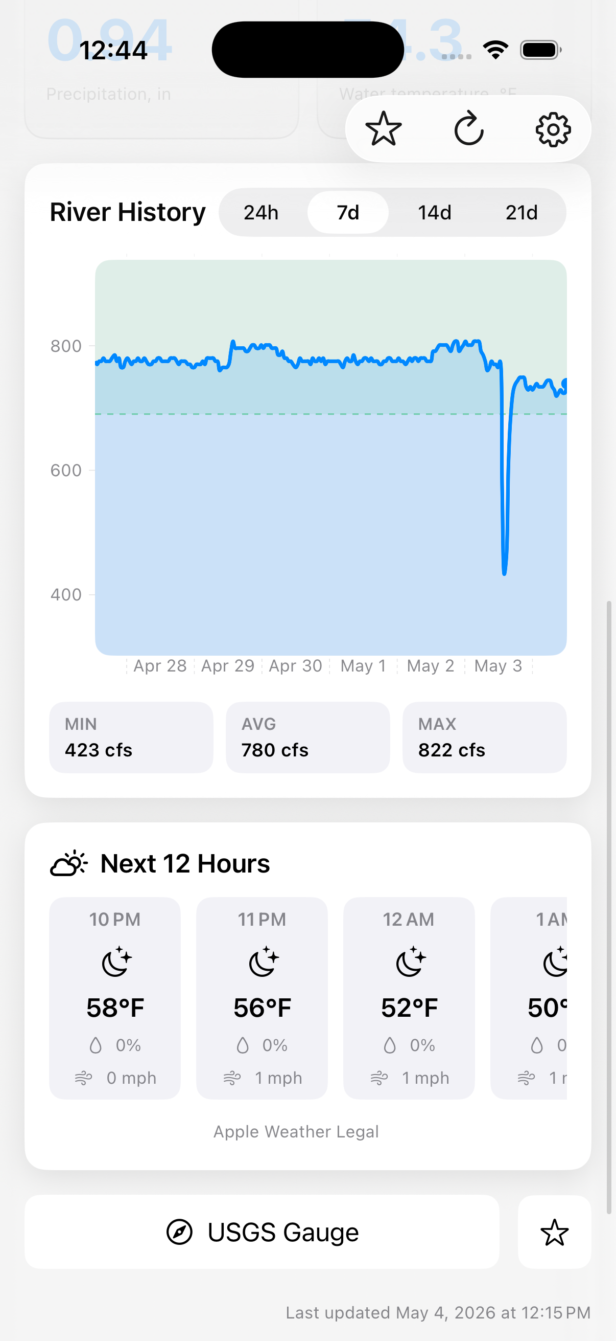
Tap any measurement to open an interactive trend chart. See how discharge, gage height, or temperature has tracked over the past 24 hours, week, two weeks, or three weeks.
Discharge, gage height, water temperature, and precipitation — every key metric from the USGS Water Services API displayed in a clean, scannable list.
USGS Water Services API
Every number in RiverFlow comes directly from USGS gauging stations — the same authoritative source used by the Army Corps of Engineers, state agencies, and flood forecasters.
Stream flow in cubic feet per second — the primary indicator of river volume and the number kayakers, canoeists, and anglers check first.
Water surface elevation above the station datum in feet. Used alongside discharge to interpret whether rising or falling conditions are normal or notable.
Measured in Fahrenheit. Relevant for fish activity, swimming conditions, and cold-weather safety on the water.
Rainfall totals at the station site. RiverFlow also calculates the rolling 3-day total so you can anticipate how upstream rain will affect conditions.
Built by an outdoorsman
I'm based in West Columbia, South Carolina — kayak distance from the Congaree and Saluda rivers. RiverFlow started as a personal tool to check conditions before heading out, built on top of USGS station data I was already checking manually.
It's a focused, purpose-built app — not a weather dashboard, not a social platform. Just the river data you need before you load the boat.
← Back to prestongrisham.comComing Soon
RiverFlow is currently in development. Follow along at prestongrisham.com for updates.